October 6, 2018
I give my life a 10.
During a recent round of physicals (to make sure I don’t fall over dead on work property), one of the doctors asked how I would rank my life.
A 10.
“Really,” he said, “are you sure? It’s not often I hear that from people.”
“I’m sure,” I said. “A 10.”
To which he responded, “Maybe you should go to Bhutan. Aren’t they all happy there, too?”
The Happiness Quotient
Bhutan has been getting a fair of amount of attention in the last few years due to its Gross National Happiness index— a confusing, yet simple set of markers that’s supposed to measure aspects of your life to rank your happiness. Big surprise, it all comes down to the simple things. People, not stuff. Relationships, not money. Love, not hate.
Apparently, it doesn’t have anything to do with the Mary Jane growing like weeds (pun very much intended) on every roadside. The locals don’t even bother with it.
In spite of this interesting attempt to attract tourists, we decided to head to Bhutan. For those who haven’t been in the loop about the country’s Gross National Happiness, there was mostly confusion over where the country is located. The simplest answer?
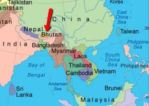 It protects India from China, and its next door neighbors are Nepal/Mount Everest and Tibet.
Why Bhutan?
And no, it wasn’t just because it was the only place we haven’t been.
We’d heard for years about its sheer beauty and the amazing people, and it’s still a bit of a new frontier. Tourism hasn’t killed its spirit just yet.
And that’s because you can’t just go to Bhutan. You can’t jump the 5-plus flights it takes to get halfway around the world, show up on their doorstep and say hello. (For reference, we took the Mpls-Seattle-Seoul-Bangkok-Kolkata-Paro route.) This means you must really, really want to go to Bhutan, and the regular tourist ruiners aren’t that committed.
In order to travel to and in Bhutan, you need to have a local guide sponsor you, get your Visa, and baby-sit you while in the country to make sure you don’t steal, litter or pee on any of the sacred temple grounds that are scattered everywhere.
Let’s start with our arrival.
After a short stop in Kolkata, India, to get gas, our A319 went up above the clouds to do a flyby of Mount Everest and a handful of the other world’s highest peaks. No big deal.
Then, the plane went down rather quickly through the clouds, and beautiful green mountains appeared everywhere around us. Not hills. Mountains.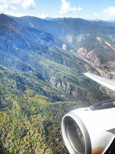
Then, the plane did what felt like 90-degree banks to keep the wings from clipping said mountains (an important thing to avoid while flying), then abruptly flew nearly straight down, hit the ground, and slammed on the brakes.
Welcome to Paro.
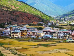
No wonder so many people take pleasure in watching the flights pirouette through the mountains. And everyone from our flight began taking pictures immediately once they stepped outside of the plane. They were taking pictures because it was unbelievable that a plane could actually land here.
Our trip was custom-made for us, so we went about it a bit differently than most tourists. Most people know Bhutan for Paro (the only “international” airport) and the Tiger’s Nest iconic hike and picture, as well as Thimphu, the country’s largest city. A few others make it a bit further to Punakha Valley and the famous Punakha Dzong and rivers.
No one goes to the Bumthang District. Or if they get to Bumthang (you can take a little plane like we did, to a little stretch of land with a small parking lot), no one gets back.
Why? Because of the current state of the national highway. Not one of the highways—the highway, meaning the only road you can use. Disrepair and major construction are its most positive attributes.
Paro, Thimphu and Punakha are spectacular, but they have been found by tourism. They’re more populated, a bit more Westernized and better connected. We wanted to see the parts of the country still somewhat undiscovered, because as soon as the national highway is done, they’ll be found.
So Bumthang became part of the plan.
I’m getting ahead of myself a bit.
For this trip, we had two guides (Matt and Namgay http://www.namgayadventuretravels.com/) design a trip for our batshit-crazy travel habits. We need to be very active until early afternoon, and ideally all before a late lunch. We need a bit of downtime after lunch (because lunch usually involves day drinking), and we need to have plenty of wine with dinner. So, they packed a trip full of hiking, biking and white-water rafting.
Then Matt sent the email about the wine that ensued panic among the six of us. In the middle of his trip detail email, he wrote that wine is hard to get in some of the hotels.
Wait, what?
Deal breaker. We all pounced via email. Did he not know our call sign was Everyday Champagne?
But never fear, our guide extraordinare had us covered. He devised a contingency plan to buy as much as we can when we can, keeping a backup stash on hand for those wineless emergencies.
OK, back in business.
After our fighter-jet-style landing in Paro, we headed up to a lunch spot (Gangtey Palace) to get a good perspective of the city 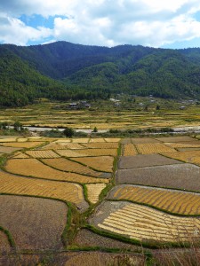 from high above before bicycling through it.
Typical of Matt, he said we had a fairly easy ride after lunch to our hotel, the Zhiwa Ling Hotel. After riding through the small city of Paro, we started our “fairly easy ride with just a few rolling hills” by riding pretty much straight up at a 4-5% grade for 20 miles. At 8,000 feet, nonetheless, which means it’s hard to breathe for us flatlanders.
We’d forgotten what it was like to travel with Matt. The man is a professional optimist in every sense of the word. In the middle of an earthquake, Matt would make it into a dance party and even miraculously find speakers in his backpack to give a tune to match the quaking beat. In a flood, he’d show up with kayaks and call it river rafting. If you fell and there was blood squirting from your veins, he’d tell a story to keep the others entertained while fixing you with leaves and gauze. A torrential downpour is cooling. Gale-force winds? Downright refreshing.
I digress.
The first night at Zhiwa Ling Hotel, 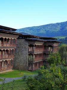 we had drinks outside by the wood-burning fire in the cleanest, coolest mountain air I’ve ever smelled. The hellish bicycle ride from earlier was suddenly remembered more fondly.
The next day, Matt went easy on us with an actually breezy bike ride through the Paro Valley, with a simple lunch and spectacular dinner at the Heritage Farm House, an inn recently renovated in true Bhutanese style.
The following day, we were heading to the heart of what Bhutan is known for: Taktstang Paro. The Tiger’s Nest.
The hike up to the Tiger’s Nest is memorable. First, it’s essentially a straight-up ascension from 8,000 – 10,000 feet. The first part of the hike, to the teahouse, is steep and a lung-buster, but very doable. After the teahouse, the climb gets more challenging (in no small part because your muscles are really screaming by now) to the money shot: the eye-level shot of the monastery made famous by everyone who’s been there, including William and Kate.
After the money shot, it gets a little precarious. You walk down steps clinging to the side of the mountain and around the corner under a waterfall, only to go back up more clinging steps to get up to the monastery. The steps are very narrow, and if you look down, you’re looking literally straight down. It’s not for the faint of heart.
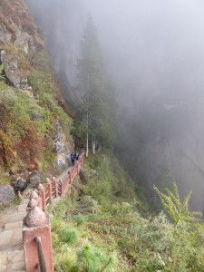
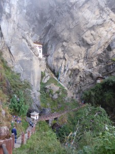
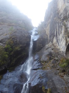
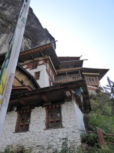
The monastery itself was certainly interesting, but the hike to get there is the highlight. We played it right by leaving before the sun rose—even though the night before (after several bottles of wine), we were whining to Namgay about such an early rise time. He was right, because we hiked up in relative seclusion just in time to see the morning fog lift from our first views of the monastery.
Once the fog lifted, David was able to truly capture:
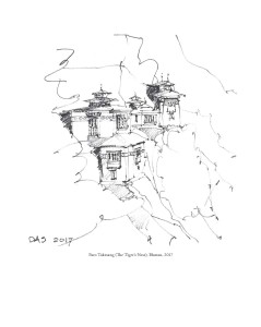
The walk down made us appreciate it even more when we had to weave through throngs of Indian tourists making their way up (mostly by donkey).
Now back to Bumthang. 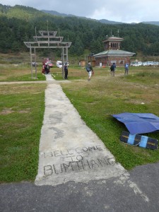
No amount of good writing could describe the remote areas of Bhutan, and since I’m not a good writer, I won’t even try.
That said, I will try to describe how you feel when you’re there. There may be more environmental factors to this whole happiness thing after all.
The air is clean, with a hint of wood-burning fire releasing smoky curls somewhere in the distance. It’s unpopulated, unlittered, uncongested. It feels almost pure, and even in the small cities, it feels somewhat sparsely populated. It just feels good to bask in the daytime sunshine, and to breathe in the brisk mountain weather at night.
Our trip continued with a short afternoon flight to a little town on the river, staying at a simple country house/inn, the Village Lodge in Jakar Valley.
After a lovely evening, we took a crisp morning bike ride up and over the Kiki La Pass (about 10 kilometers all up) with its famous prayer flags. 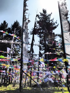
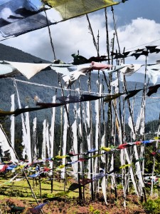
Our ride took us from Jakar Valley to Chumey Valley and to our next remote hotel, the Chumey Nature Resort. We had now officially found the middle of nowhere, in case you’re wondering where it actually is.
After walking through the area in the morning to see the smoke from everyone’s prayer offerings rising into the sky, we were officially introduced to the aforementioned national highway.
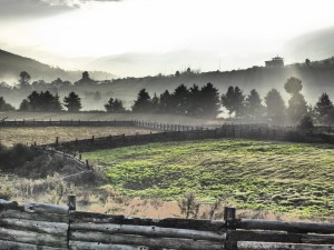
It wasn’t pretty.
What was supposed to be about a 2-3 hour van ride followed by some bicycling turned into about 7 hours in the van, up and over two insane mountain passes. Envision a passenger van on the rockiest, most precariously narrow, steepest road, with no guardrails and a clear view straight down the mountain.
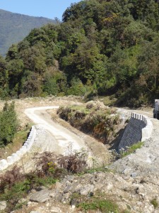
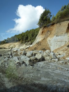
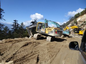
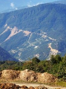
Now picture said passenger van meeting a giant piece of road construction equipment in a game of chicken. Welcome to our day.
Matt? He stopped at a roadside stand to buy yak cheese, native to Bhutan, as part of our ongoing entertainment. Heads up: Yak cheese is like sucking on a flavorless shoe. After about 6 hours in that van, it was still perfectly intact. But apparently it’s good for you (which probably explains the taste).
By the time we reached our hotel, we were sore, stressed, claustrophobic, generally pissed off and tired.
Then we walked into the Gangtey Lodge.
We’ve stayed in a lot of hotels. I’ve spent more nights in a hotel than an average 30-year-old has spent in their own bed.
And this was top 5. Maybe even top 3. Ever. In the world.
When we walked in, the entire staff greeted us with drinks and prayer scarves, sang a short Bhutanese welcome song and led us to leather chairs, which we sank into and proceeded to receive neck massages, all while looking out into the magical Phobjikha Valley. There really aren’t enough superlatives to describe the mountains and valleys of Bhutan.
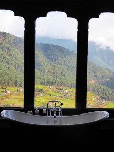
The Gangtey had the best of everything on the trip: food, room, view, linens, candy, water, air, pillows, hallways, carpet, chairs, doorknobs—you name it.
After showering in (you guessed it) the best shower, we went to the main lodge for happy hour, and then spilled out onto the outside deck by the fireplace. The staff brought us thick, soft blankets and heated neck warmers to go with our champagne and the best snacks ever. And we were overlooking mountains and valleys with a village and monastery from the 16th Century.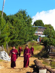
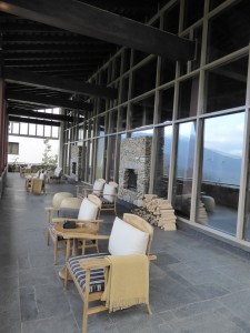
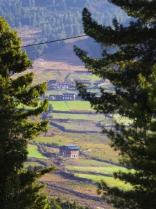
Yep, this kind of stuff happens every day.
Sadly, we couldn’t stay there forever, unless we wanted to eat up our 401K in a few weeks.
We had a great morning walk through the small village to get a glimpse of remote daily life.
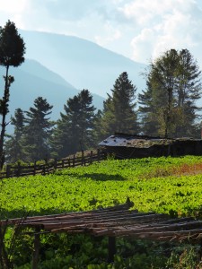
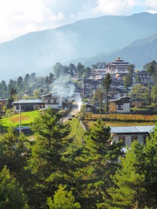
Then, it was followed by most memorable bike ride of our lives. It was about 45 kilometers down from the mountain pass to the Punakha Valley. This time, we tackled the monstrous national highway construction on bike, and it was a combination of off-roading, mountain biking and dodging everything from sheer drops to goats to cows to monkeys, not to mention the construction workers hauling giant rocks.
It was a blast. And our hands were completely cramped up for the next two days.
Next, we went on to Punakha Valley, one of the more well-known areas of Bhutan because of the Punakha Dzong. It’s a 1637-built temple where the current king got married in 2011, and it’s a must-see.
Our Punakha Valley hotel, the Dhensa, was straight up the hill/mountain (big surprise, everything is either straight up or straight down in the country) overlooking the Po Chhu River and its intersection with the Mo Chhu River.
It’s an incredible valley to visit, and the Dzong sits with a prominent position on the confluence of Po and Mo, with a backdrop of the Himalayas. The river is ideal for white-water rafting followed by picnics with the Bhutanese cows.
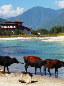
The mountain biking through the valley is the perfect way to see the rice harvest and daily life of the Bhutanese.
When we arrived at our next stop, Thimphu, it was almost a letdown. Don’t get me wrong, it is an incredible little city guarded by a giant hilltop Buddha you can see from overhead airplanes, but getting into any kind of city after all the beautiful remoteness jolted us back a bit. We did have a hike outside of Thimphu that rivaled the Tiger’s Nest. It was another solid straight-up hike, but at the monastery at the top, we were greeted with monks doing their daily chant.
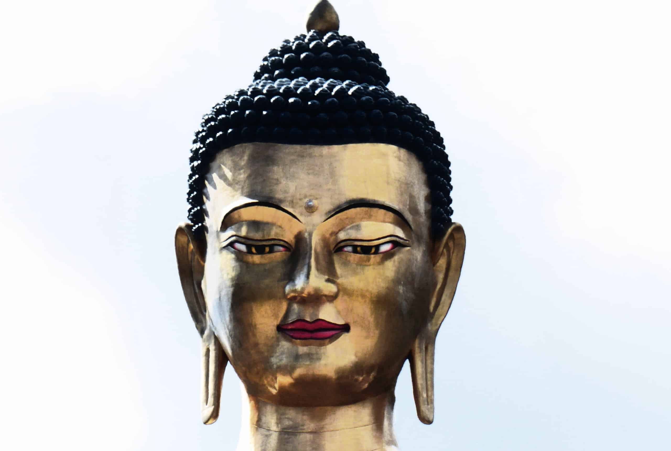
And a trip to Thimphu wouldn’t be complete without a hike up to the Buddha Dordenma Statue. It’s almost 52 meters tall and made of bronze, gilded in gold. We walked several clockwise laps around the giant structure to invoke good blessings and take in all the Bhutanese receiving blessings (even the smallest) high about Thimphu.
During our stay in Thimphu, the undisputed highlight was dinner at our guide Namgay’s house with his beautiful family. We got a real glimpse of Bhutanese homes and lives.
Our trip was now coming into its home stretch. When we booked the trip, a 10-day adventure seemed unbearably long. Now it had flown by. The wine was never a problem, with all hotels having a least a decent selection of wine and Bhutanese beer. So as our trip was wrapping up, we found ourselves in a unique and unheard of position: We had wine left to drink. We even found and tasted the local swill, Ara, made from rice in small batches only for local consumption. With Ara, we also found ourselves in a unique position: It was undrinkable. On a more positive note, it’s supposed to (and did) ward off snakes. We didn’t see one creature that unspeakably moves without legs while we were there.
The second-to-last day, we had the best bike ride of the week, from Haa Valley back into Paro. It was a lot of up and down (what a surprise), and not as technical as the few days earlier. On this ride, every view and vantage point was better than the last, and after 9 days, the altitude didn’t have the same power over us.
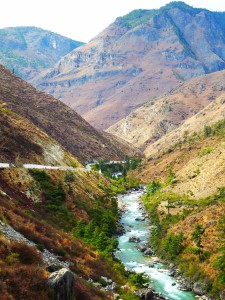
Off to our final night at Le Méridien before fighter-jet flying straight up and over the mountain to say our final goodbye to Mount Everest and her friends.
Other Resources:
Coolhunting has a great piece on navigating Bhutan as well.
Bhutan by the Numbers:
Biking Mileage: 163.5 miles
Walking: 12 miles
Biking elevation gain: 3800 feet
Walking elevation gain: 2000 feet
Frequent Flier Miles Earned: 26,000 miles


